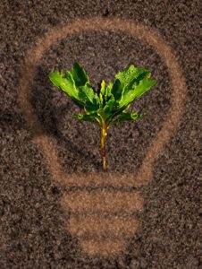
Technology is increasing at a rapid pace throughout the business world. This is as true for Farming as it is in and other industry.
One of the developments of the last few years that has incredible potential is the adoption of UAV (unmanned aerial vehicles) known commonly as drones by farmers to increase productivity.
To understand how drones can help farmers we must first explore the concept of precision agriculture.
Precision agriculture is a farm management concept based on observation, measurement and specific response to small variability in crops.
Precision agriculture helps to efficiently apply limited resources to gain maximum yield. The best wat to do this is to minimize variation in crop health within and between fields.
Precision agriculture requires accurate and wide-ranging data to work.
The three main types of data required are:
Geotagged Images:
Aerial images taken of fields over time, both visible and multi-spectral over time.
Equipment Performance:
Feedback from sensors in real-time & performance logs provided by manned and unmanned equipment such as tractors, seeders, spreaders, and combines.
Farm Management Data:
Yield data and input cost data provided by the farm operator.
Drones are an obvious fit within precision agriculture.
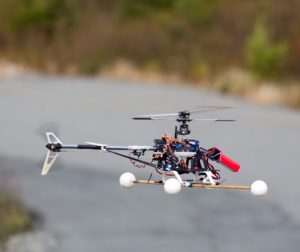 Drones are a new, low-cost and high-precision way to obtain geo-tagged aerial survey images.
Compared to other aerial survey methods, drones allow for more frequent and precise data collection about the condition of crops. Aerial data can be used to improve the performance of a farm’s operation in many important ways.
In the case of smaller farms, drones are significantly more cost effective than other forms of aerial photography, including manned flights and satellite imagery.
Drones are used to capture images that can provide a variety of data about the condition of fields, livestock, and crops.
Some of the Information that can be ascertained from drone obtained images include:
- the height of plants
- number of plants
- the health of plants
- nutrient presence (or lack)
- Disease
- weed count
- biomass estimates (relative)
- topographical data including patches, hills, and holes.
- location of livestock
- movement patterns of livestock
Data from drones can help accomplish farm tasks more easily:
- replace people in scouting tasks
- monitor crop health
- survey/scout fields prior to planting
- measure nitrogen requirements
- monitor yields
- assess drought situations
- classify trees
- more uses
The images generated by drones can be fed into an agricultural program or other software tools to create maps that prescribe specific actions to improve performance.
It’s clear that drones and other technology are becoming must-have tools for Canadian farmers. As a result, financial investment that keeps a farm up to date has become a priority.
Many farmers need to look for outside investment to increase technological capacity.
Please contact Canadian Grants Business Center for assistance in obtaining government funding to start or expand your farm business:
Visit : http://www.canadiangrantsbusinesscenter.com
Or call Toll-Free: 1-888-231-0075 for help during the business day.
First time to your site and just had to say thank you!